When working with older material from Scott County, Virginia, I find myself frequently encountering references to the old magisterial districts. A magisterial district is a subdivision of a county in the Commonwealth of Virginia, “used in conducting elections or recording land ownership.”
Scott County today has six magisterial districts, numbered 1 through 6. However, from 1870 until at least the middle of the 20th century, Scott County had these magisterial districts (“clockwise” from due north):
- Dekalb District. This district spanned the north-central part of Scott County (now mostly in District 5), and was crossed by Copper Ridge, Chestnut Ridge and Stone Mountain. The principal community of this district was Fort Blackmore. According to Addington, this district derives its name from a personal friend of one of the county commissioners who originally divided Scott County.[*]
- Floyd District. This district made up the northeast part of the county, north of Copper Creek Ridge. The principal community was Dungannon. Today this area is split between Districts 3 and 5. According to Addington, this district was named in honor of Governor John Floyd.
- Johnson District. This district was in the eastern part of Scott County, between Clinch Mountain and Copper Creek Ridge. The principal community was Nickelsville, and today is within District 3. According to Addington, this district was named in honor of a Johnson family.
- Fulkerson District. This district was in the southeast part of the county, between Clinch Mountain and the Tennessee state line, with the North Fork of the Holston running along its axis. It extended from a line running south-and-southwest starting from the Big Knob (a little west of Hiltons), east toward Washington County, and including the Poor Valley communities of Hiltons and Maces Spring. Today this roughly corresponds to District 2. According to Addington this was named in honor of early settlers James and Abraham Fulkerson.
- Estillville District. This district lay in the south-central part of the county, including today’s District 1 and District 4. According to Addington it’s name derives from the original name of the county seat, Estillville (now Gate City). In addition to Gate City, modern communities in this district include Weber City (Moccasin Gap) and Yuma. It stretched from west of Hiltons on the east side, to the Clinch River on the west side.
- Powell District. This district was in the southwest part of the county between the Clinch River and Powell Mountain, roughly the western half of today’s District 6. It is fairly sparsely populated. According to Addington, it is named for Ambrose Powell.
- Taylor District. This district lay in the northwest part of Scott County, in the area north of the Clinch River and inclusive of the Natural Tunnel State Park. The primary communities are Duffield and Clinchport; the Rye Cove community was also in the Taylor District. Addington states that the district was named in honor of the Taylor family.
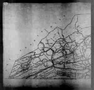
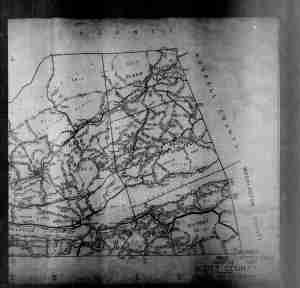
Maps of the districts from the 1940 Census are attached below.
A few other notes from Addington’s treatise:
- Scott County was formed in 1814 from parts of Washington, Lee and Russell Counties. It was previously a part of Fincastle County (1772-1777), Botetourt County (1769-1772) and Augusta County (1745-1769).
- The southern boundary line with Tennessee was very contentious for many years due to mistakes in the Walker Line; the surveyors ran the line several miles too far to the north of the intended boundary of 36 degrees and 30 minutes north latitude.
Quoting from Addington in full:
SOME COUNTY GEOGRAPHICAL NAMES
Most of the county’s leading geographical features, such as its principal mountains and streams, had received their names before the coming of the first permanent settlers. In 1774, Capt. Daniel Smith made a map of the region now comprehended within the boundaries of Scott County. This map contains the following names: Clinch River, Guess’s River, Rye Cove, Cove Creek, Stony Creek, Copper Creek, Copper Creek Ridge, Falling Creek, Hunters’ (Osborne’s) Ford, Sinking Creek, Castle’s Run, Mockason Creek, Poor Valley, North Fork of Holston. Evidently, therefore, hunters and explorers had been here prior to 1774 and had applied these names often enough to somewhat fix them in the minds of the frontier people.
Holston – Stephen Holston discovered the river which bears his name some time prior to 1748. His cabin was located at the head spring of the Middle Fork of the Holston. Thus the river, sometimes called the Cherokee River, finally took the name of Holston.
Clinch River – Dr. Thomas Walker, in his Journal of 1749-1750, says that the Clinch River took its name from one Clinch, a hunter who first found it. There is a somewhat fanciful story as to the origin of the name. This story relates that an Irishman who could not swim attempted the crossing of the river on a raft. Falling off the raft in mid-stream, he excitedly called to his companions, “Clinch me! Clinch me!” and that this circumstance led to the river’s being called Clinch. There are other versions of this story. Clinch Mountain took its name from the river, no doubt.
Copper Creek and Copper Creek Ridge – In the survey of John Blackmore, Jr.’s, farm the ridge south of Clinch River was called “Copper Creek Ridge.” This survey was made in 1774. The author has been unable to find out why the word “Copper” was used.
The Big Knob – A peak of Clinch Mountain, 3,217 feet high. It is situated five or six miles east of Gate City. A part of this highland is called Signal Pole Knob.
Hiltons – A small village situated on the Appalachia Division of the Southern Railway [ed. note — this railroad no longer operates, it is paralleled by the A.P. Carter Highway today]. It was named in honor of the Hilton family. One of the county’s high schools is located there [ed. note — the high school no longer exists, although there is an elementary school in Hiltons].
Clinchport – A town twelve miles west of Gate City, located at the confluence of Stock Creek and Clinch River. It was probably named in anticipation of the development of the Clinch as a navigable stream.
Big Poor Valley – A valley skirting the base of Clinch Mountain on the south side throughout the entire length of the county, and is named on account of the sterility of the soil.
[*] Robert M. Addington. History of Scott County, Virginia. 1932 (and 1992 reprint). pp. 4, 10-11, 137-140.


Pingback: The Marriage of Robert Salyer and Earlie Bays, 1908 | Archerology
I am interested in using a portion of this article in another publication so please contact me.
LikeLike